Guédiawaye Department (Guédiawaye Department)
Guédiawaye Department is one of the 45 departments of Senegal and one of the four making up Dakar Region on the Cap-Vert peninsula.
It comprises a single arrondissement, Guédiawaye Arrondissement, which is subdivided into 5 communes d'arrondissement :
* Ndiarème-Limamoulaye
* Golf
* Sam-Notaire
* Wakhinane-Nimzatt
* Médina-Gounass
In the census of December 2002 the population of the department was recorded as 258,370. In 2005, it was estimated at 286,989.
* Population
Map - Guédiawaye Department (Guédiawaye Department)
Map


Country - Senegal
 |
 |
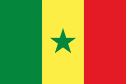
| Flag of Senegal | |
Senegal is notably the westernmost country in the mainland of the Old World, or Afro-Eurasia. It owes its name to the Senegal River, which borders it to the east and north. The climate is typically Sahelian, though there is a rainy season. Senegal covers a land area of almost 197000 km2 and has a population of around million. The state is a unitary presidential republic; since the country's foundation in 1960, it has been recognized as one of the most stable countries on the African continent.
Currency / Language
| ISO | Currency | Symbol | Significant figures |
|---|---|---|---|
| XOF | West African CFA franc | Fr | 0 |
| ISO | Language |
|---|---|
| FR | French language |
| WO | Wolof language |